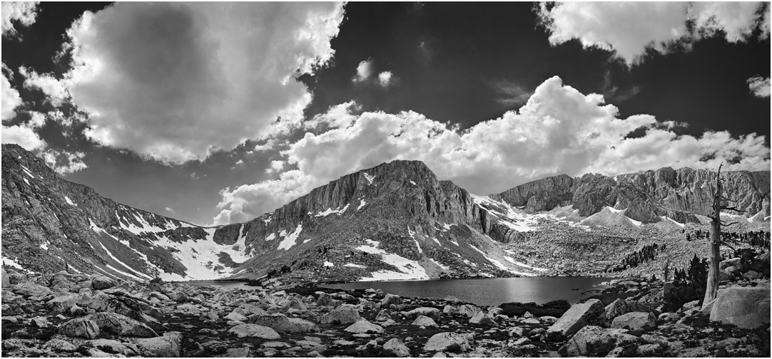
At slightly over 11,000 feet in elevation, Lakes 4 and 5 are the largest in the Cottonwood Lakes Basin. The basin is an easy day hike out of Golden Trout Camp.
Old Army Pass is on the left, just above the barely visible Lake 4. Often dangerously covered with snow, Old Army Pass is the shortest route to 14,000 ft. Mt. Langley.
The stream at the outlet of Lake 4 is one of the best places to see large Golden Trout. California Fish and Game staff use traps in that spot to catch the fish for collecting eggs and other purposes.
Just to the right of the Foxtail Pine snag on the right (and not shown in this picture) is an amazing campsite and shelter. A wind-blown, dwarf conifer covers an area between two large boulders. Campers have erected a "doorway" into this sheltered space that makes it look particularly inviting. With a lamp hanging from the "ceiling" of the shelter, we spent a very pleasant evening in this nice, backcountry "living room."
This panoramic image of the basin holding Lakes 4 and 5 is manually stitched from many medium format Technical Pan negatives, making a file that is about 20,000 pixels wide. In addition to using multiple frames to make panoramas that are wider than normal cameras can take, I also merge frames that were focused at different points. This focus stacking allows depth of field that is beyond what a single frame can capture. The net result is very high image sharpness and detail across the entire, sometimes very large print.